GBWHS Merchandise
Reduced Price!Enjoy each day
|
 |
NOTE: If you are a Sustaining Member of the GBWHS, you will receive a complimentary calendar. Thank you for your support!
All merchandise is sold by mail order.
Click here for a merchandise order
form.
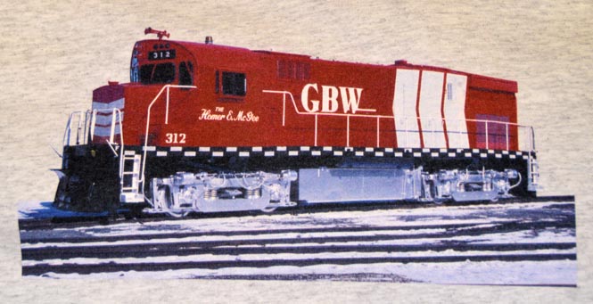
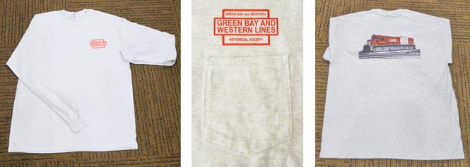
GBWHS T-shirts
Available exclusively from the Green Bay & Western Historical Society!
It’s light grey with a red GBWHS logo on the left front above the pocket.
The back is a custom screen 4 color process photo of GBW C424 312 in its
one-of-a-kind chevron paint scheme honoring past GBW President Homer E.
McGee. The photo was taken by Larry Nast in February 1982, right after the
312 left the paint shop.
This is a high quality Gilban Ultra Cotton/Polyester Blend shirt (99% cotton, 1% polyester). It’s very comfortable and durable, with minimal shrinkage. This is the same type of shirt used by Soo Line Railroad Employees Society with a long positive track record. It’s available in short sleeve sizes M, L, XL, and 2XL. Prices are $23 for GBWHS members and $26 for non-members. Click here for an order form.
Track Plans and Maps
Track Plan - Kewaunee Carferry Yard - $12.00
Shows the tracks and buildings of the car ferry yard at Kewaunee.
(1957,
1"=50', 68" x 24")
Track Map - Luxemburg - $4.00
Showing a double-ended siding north of the main line and a single-ended
spur on the south side, with hand-written notes dated 1963 and 1964 giving
distances from the main line to GBW's property lines.
(ca. 1964, 19"x17")
Track Map - Norwood Yard - $6.00
GB&W Engineering Department drawing of Green Bay Shop Grounds. Map covers
Twelfth Ave. to Oakland Ave., Clinton Street to north of the grain elevator.
GBW shop and elevator buildings are labeled.
(December 1971, 1"=50', 33"x17")
Track Plan - East Green Bay - $6.00
Shows the arrangement of tracks between the east end of Procter & Gamble
paper mill at Quincy Street, along Eastman Avenue, and to the University
Avenue crossing. Includes the spur to the Procter & Gamble East River
mill along Clay Street.
(40"x17")
Track Map - Hoberg (Charmin) Paper - $4.00
Shows the arrangement of the four spur tracks at the Hoberg Paper (Charmin,
Procter & Gamble) mill on the East River. The map extends from the East
River to Harvey St., Jackson St. to Clay St.
(12" x 24")
Track Map - Mason St. Proposal - $6.00
City of Green Bay engineering survey for the proposed Mason Street bridge
replacement. Map covers Norwood Ave. to the east bank of the Fox River,
Waverly Place to School Place. GBW, CNW and MILW tracks on the near west
side of Green Bay are labeled.
(1966, 1"=300', 17"x24")
Track Map - Alma Center - $7.00
GB&W Engineering Department drawing of Alma Center. Stock yards, warehouses
and lumber yards adjacent to the railroad are identified.
(1916, 1"=100', 55"x23")
Showing a double-ended siding north of the main line and a single-ended spur on the south side, with hand-written notes dated 1963 and 1964 giving distances from the main line to GBW's property lines
(ca. 1964, 19"x17")
Track Map - Merillan - $7.00
GB&W Engineering Department drawing. GB&W and CStPM&O main line, yard, and interchange tracks are hsown. Depot and other railroad-owned structures are identified.
(1916, 1"=100', 55"x23")
Map - 1964 System Map - $5.00
System wide map showing active and abandoned stations, and connecting railroads.
(1964, 1"=7.5 mi., 20"x13")
Map - 1976 Locality - $5.00 System wide map showing stations and connecting railroads.
(1954, with revisions through 1988)
If you questions about merchandise or ordering, please contact
shows@gbwhs.com.
Thank you!